
Chemin de Villarnard
Access
Starting from :
Latitude :
6.592419
Longitude :
45.432747
Map ref. :
This trail leads to the Villarnard hamlet, a classic example of local heritage. Shuttle bus return.
Route de Praz Juget, after the roundabout (La Tania exit, heading towards Méribel)
By shuttle bus, get off at the “La Tania” stop.
By car, drive to La Tania from Le Praz and park in Le Formier car park, in the centre of La Tania.
Continue on foot, heading towards Méribel until you come to the roundabout at the resort exit. The downhill trail starts on the right 100 metres after the roundabout.
Services
Rates
Free of charge.
Period(s) of use
From 01/05 to 31/10From 01/05 to 31/10
Subject to favorable weather
Home
Pets allowed
Things to discover nearby
Explore our hikes

Pedestrian sports
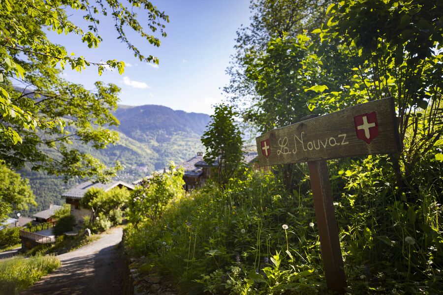
Circuit de la Nouvaz
Courchevel
2km
Walkers/hikers
140m
140m
This path leads to the pretty hamlet of La Nouvaz, where it passes underneath a stone arch between 2 houses then climbs back up and loops through the forest. May be combined with Le Chemin des Chevreuils path.

Pedestrian sports
Sentier des Verdons
Courchevel
2.8km
Walkers/hikers
10m
320m
This route takes you up in a gondola lift, giving you great views of the Grande Casse (highest peak in the Savoie region: 3,855m). Look out for marmots on the ledge 100 metres from the gondola lift station. Watch out for cyclists and golfers.

Pedestrian sports
Jardin Alpin
Courchevel
km
-m
-m
Despite being an urban walk, this route includes a few green spots, and will take you to discover some of the resort’s most beautiful hotels.


