


01 / 04
Crêtes du Mont Charvet
Accesso
Partendo da :
Latitudine :
6.667388
Longitudine :
45.409121
Riferimento mappa :
This high-level walk takes you past sinkholes and offers amazing panoramic views.
When you get to Le Biol, you’ll see a stone - the remains of the old mountain hut that was carried away by an avalanche in 1999.
Lac de la Rosière Car Park
By shuttle bus (line H), go to the end of the line and get off at the “Lac de la Rosière” stop.
By car, turn left at the first roundabout as you come into Courchevel Moriond, take several sharp bends heading towards Belvédère and take “Route de la Rosière” going downhill on the left, on the same level as the hiking symbol, just after Le Zenith hotel.
It can sometimes be difficult to park at La Rosière, so we recommend that you park at the Cimes Blanches car park (free covered car park in summer) in Courchevel Moriond, and take a shuttle bus that will drop you right at the site entrance.
Servizi
Prezzi
Gratuito.
Periodo(i) di utilizzo
Da 01/05 a 31/10Da 31/05 a 31/10
Con riserva di condizioni atmosferiche favorevoli
Casa
Animali domestici ammessi
1/4

Da scoprire nei dintorni
Esplora le nostre passeggiate

Sport pedestri
Aquamotion
Courchevel
km
-m
-m
Il sentiero passa per l'antico borgo di Moriond, per cui è d'obbligo una sosta all'Aquamotion, il più grande centro acquatico della montagna.

Sport pedestri
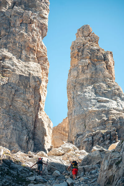
Brèche de Portetta
Courchevel
11.4km
Escursionisti
830m
830m

Sport pedestri
Descente Courchevel Le Praz
Courchevel
2km
Escursionisti
10m
210m


