


01 / 04
Chemin des chevreuils
Access
Starting from :
Latitude :
6.597822
Longitude :
45.431788
Map ref. :
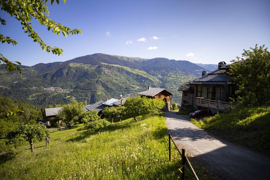
Cut out of the rock face, this footpath links the villages of Le Praz and La Tania and gives you pretty views of villages on the facing mountainside.
“Chemin des Chevreuils” Hiking Symbol
By shuttle bus, get off at the “La Tania” stop.
By car, drive to La Tania from Le Praz and park, either in Le Saz car park before returning to the resort, or in Le Formier car park in the resort centre.
A hiking symbol is located next to the “Route de Praz Juget” at the resort entrance, down from the La Tania gondola lift departure station.
Services
Rates
Free of charge.
Period(s) of use
From 01/01 to 31/12
Subject to favorable weather
Home
Pets allowed
1/4

Things to discover nearby
Explore our hikes

Pedestrian sports
Courchevel Le Praz - Montcharvet - La Jairaz
Courchevel
6.9km
Quite hard
150m
150m
This panoramic circuit enjoys unobstructed views of the Grand Bec and villages on the opposite mountainside. The route might be a little long for anyone who isn’t used to walking.
Pedestrian sports
Chemin des chevreuils
Courchevel
4.1km
Level green – easy
100m
100m
Cut out of the rock face, this footpath links the villages of Le Praz and La Tania and gives you pretty views of villages on the facing mountainside.

Pedestrian sports
Boucle de Mateigena
Courchevel
2.4km
Walkers/hikers
130m
130m
This shortish and rather steep path winds through the forest, taking you to a pretty clearing and some ponds.


