
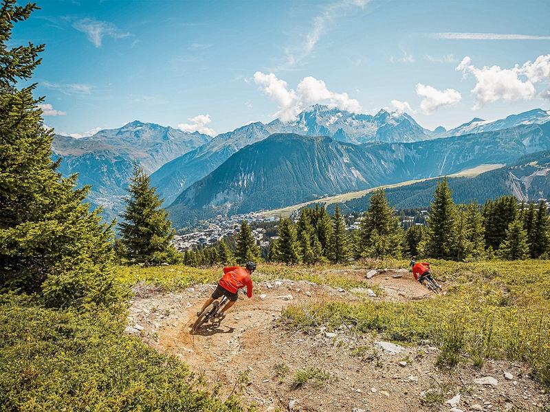
Enduro - La Foré
Access
Starting from :
Latitude :
6.610819
Longitude :
45.417838
Map ref. :
Red Enduro trail between the top of the La Tania gondola and Courchevel 1850.
Services
Rates
Free access.
Period(s) of use
From 01/07 to 31/08
Subject to favorable weather
Home
Pets allowed
Things to discover nearby
Explore our hikes

Pedestrian sports
Chemin du moulin de Villaflou
Courchevel
4.2km
Walkers/hikers
270m
270m
This orchard trail links the hamlets of Villaflou, which has an authentic watermill, and Le Freney.

Pedestrian sports
Le Grenier, Le Fay, Les Moulins
Courchevel
5.4km
Walkers/hikers
230m
240m
This circular hike can be extended to include three other hamlets or even Lac de Bozel, for the more daring among you.

Pedestrian sports
Contemplation trail
Courchevel
1.6km
Walkers/hikers
135m
135m
This original trail, designed for a wide audience, invites walkers to discover nature in the heart of the Mateigena forest, in a sensitive and immersive way.


