


01 / 02
Via ferrata de la Croix des Verdons
Accesso
Partendo da :
Latitudine :
6.610241
Longitudine :
45.383547
Riferimento mappa :
France's highest via ferrata!
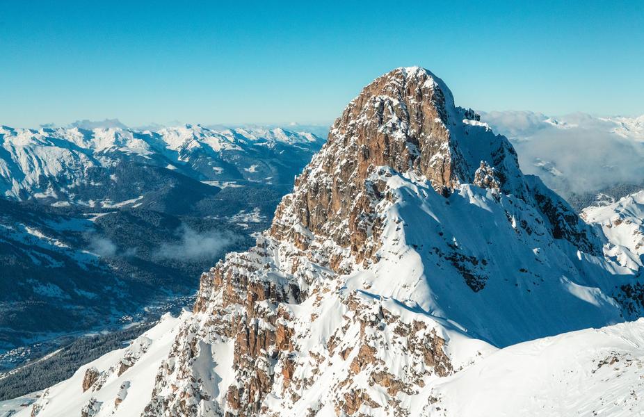
This rather vertiginous via ferrata takes you across the Verdons ridges, in a dolomitic atmosphere.
The route follows ledges, benches and rocky overhangs to the pointe du Curé, then passes the col de la Croix and climbs up to the Croix des Verdons (or Dent de Burgin), offering a fine panorama of the glaciers and peaks of the Vanoise.
Progress using a 1 km safety cable and 650 rungs.
Accessible in summer by lift (Verdons gondola, then Saulire cable car)
or in autumn on foot from the Altiport (2h walk and 700m D+).
Descent via a scree corridor and then the piste to Les Verdons.
IMPORTANT
Before embarking on a via ferrata, you must :
- know and apply safety instructions
- know the main via ferrata hazards
- ascertain the expected level of difficulty and your current physical abilities
- equip yourself with warm clothing and the right technical equipment (and use it correctly)
- make sure none of the components are part of products recalled by manufacturers
If you have any doubts, don't hesitate to ask a professional mountain guide to help you.
Servizi
Prezzi
Accesso libero.
Periodo(i) di utilizzo
Da 01/07 a 31/08
Con riserva di condizioni atmosferiche favorevoli
Casa
Non si accettano animali domestici
1/2

Da scoprire nei dintorni

Esplora le nostre passeggiate

Sport pedestri
Circuit de la Nouvaz
Courchevel
2km
Escursionisti
140m
140m
Questo sentiero conduce alla graziosa frazione di La Nouvaz, dove passa sotto un arco di pietra tra due case e poi risale attraverso un anello nel bosco. Può essere combinato con lo chemin des chevreuils.

Sport pedestri
Rocher de Villeneuve
Courchevel
15.7km
Livello rosso – difficile
1300m
1300m

Sport pedestri
Lacs Merlet
Courchevel
9km
Per sportivi principiante
470m
470m


