

01 / 02
Passage de Plassa
Access
Starting from :
Latitude :
6.660478
Longitude :
45.408262
Map ref. :
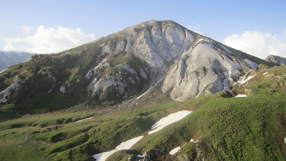
This path leads to a monumental cairn (3.5m).
Beyond the passageway, a vast scree slope reveals the remains of a plane that crashed on December 19, 1969.
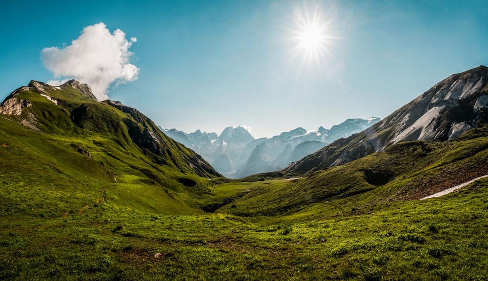
COL DE MEY (8'')
- temps de marche : 8h30
- distance : 20,3 km
- dénivelé : D+ 1270 m / D- 1270 m
For the more experienced, a via cordata (a rocky footpath equipped with a cable) allows you to continue to the Col de Mey mountain pass. Not a good idea if you suffer from vertigo!
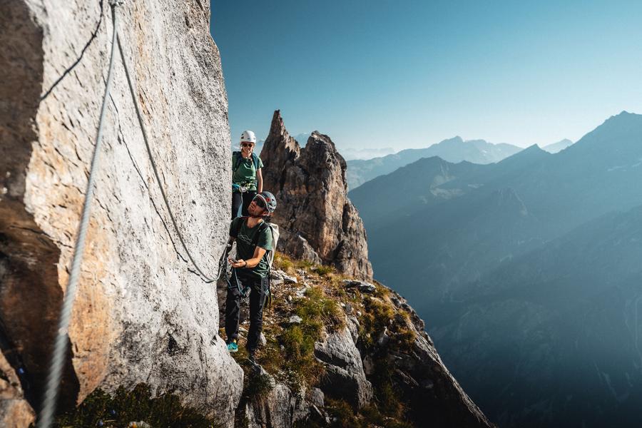
VIA CAVO DEL MEY, a vertiginous and breathtaking hike (via cordata)
- temps du parcours : 1h00
- distance du parcours : 0,8 km
- dénivelé : D+ 180 m
Reserved or adventurers and sports enthusiasts who love thrills, the brand new Courchevel hike makes you feel...dizzy. A cabled course on rocky ledges facing the Vanoise glaciers. Helmet, lanyards and harness required.
Services
Rates
Free access.
Period(s) of use
From 01/05 to 31/10
Subject to favorable weather
Home
Pets allowed
1/2

Things to discover nearby
Explore our hikes

Pedestrian sports
Abri du Bec de l'Aigle
Courchevel
2.6km
Walkers/hikers
170m
170m
There is a Mediterranean forest feel to this route, which takes you to a stone shelter.

Pedestrian sports
Arête de la Saulire - Col du Fruit
Courchevel
10.2km
Walkers/hikers
140m
450m
This route gives you a taste of the high mountainside and the wild natural landscape at the entrance to the Vanoise National park. Amazing panoramic views over the Courchevel and Méribel valleys.

Pedestrian sports
Lacs Merlet - Col de Chanrouge
Courchevel
16.7km
Level red – hard
810m
810m
Extend your walk for a view out over a third lake, the Lac du Pêtre. From the mountain pass, enjoy unrivalled views of the Courchevel valley, the La Plagne ski area and the Mont Blanc mountain range.


