
Piou-Piou
Access
Starting from :
Latitude :
6.619
Longitude :
45.396383
Map ref. :
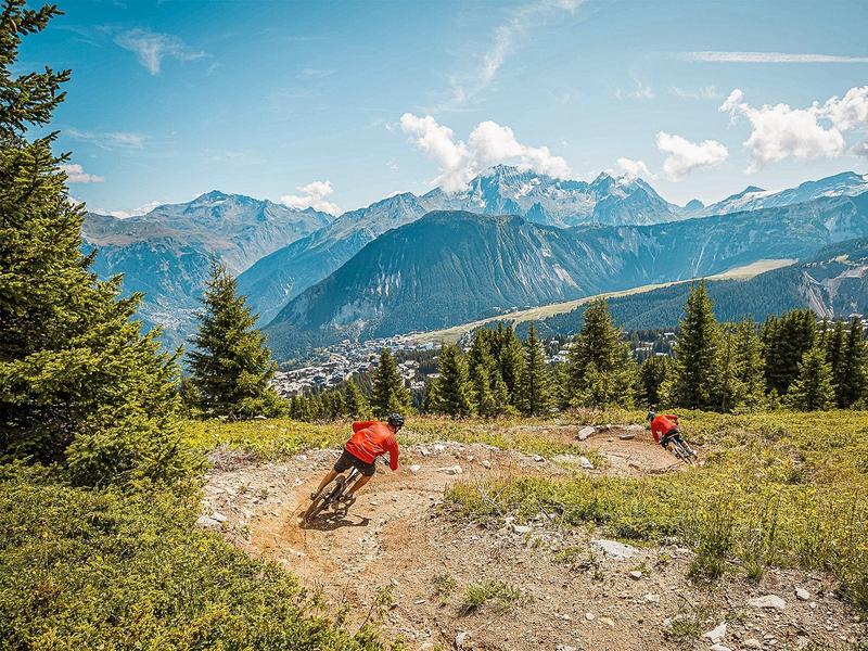
Piste verte parfaite pour sa première expérience du VTT sur piste de descente.
Principalement en prairie, sur le domaine skiable, la partie finale sillonne dans une belle forêt.
Mouvements de terrain, passerelles et virages relevés pour le côté ludique (mais pas de sauts !).
Services
Rates
Free access.
Period(s) of use
From 01/07 to 31/08
Subject to favorable weather
Home
Pets not allowed
Things to discover nearby
Explore our hikes

Pedestrian sports
Circuit des Teppes
Courchevel
3km
Level green – easy
130m
130m
A great place to relax and have a picnic with the added bonus of a view of the Grand Bec, the Tarentaise Valley and the resort of Courchevel La Tania from a viewpoint on the way back. You can do a circuit via the 4x4 track.

Pedestrian sports
Le Grenier, Le Fay, Les Moulins
Courchevel
5.4km
Walkers/hikers
230m
240m
This circular hike can be extended to include three other hamlets or even Lac de Bozel, for the more daring among you.

Pedestrian sports
Brèche de Portetta
Courchevel
11.4km
Walkers/hikers
830m
830m
See the Savoie region’s very own little Dolomites: explore the mineral-rich environment between the tall needles of rock. Watch out for snow fields at the start of the season. Don’t leave your car for too long at the foot of the rock face (danger of rock falls).


