
Tour de la Dent
Access
Starting from :
Latitude :
6.668345
Longitude :
45.407716
Map ref. :
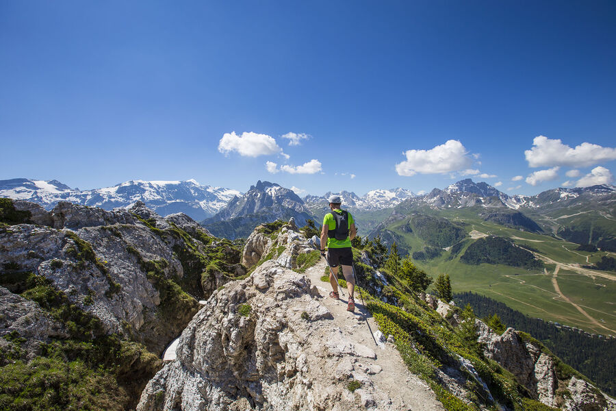
Passing through a protected wilderness area, this path is full of curious geological features related to gypsum. Few people walk this route. Tell someone exactly where you’re going, start out early and do not attempt in stormy weather.
Lac de la Rosière Car Park
By shuttle bus (line H), go to the end of the line and get off at the “Lac de la Rosière” stop.
By car, turn left at the first roundabout as you come into Courchevel Moriond, take several sharp bends heading towards Belvédère and take “Route de la Rosière” going downhill on the left, on the same level as the hiking symbol, just after Le Zenith hotel.
It can sometimes be difficult to park at La Rosière, so we recommend that you park at the Cimes Blanches car park (free covered car park in summer) in Courchevel Moriond, and take a shuttle bus that will drop you right at the site entrance.
Services
Rates
Free of charge.
Period(s) of use
From 01/05 to 31/10From 01/05 to 31/10
Subject to favorable weather
Home
Pets allowed
Things to discover nearby
Explore our hikes

Pedestrian sports
Arête de la Saulire - Col du Fruit
Courchevel
10.2km
Walkers/hikers
140m
450m
This route gives you a taste of the high mountainside and the wild natural landscape at the entrance to the Vanoise National park. Amazing panoramic views over the Courchevel and Méribel valleys.
Pedestrian sports
Tour de la Dent
Courchevel
12.9km
Walkers/hikers
1080m
1080m
Passing through a protected wilderness area, this path is full of curious geological features related to gypsum. Few people walk this route. Tell someone exactly where you’re going, start out early and do not attempt in stormy weather.

Pedestrian sports
Passage de Plassa
Courchevel
24.7km
Walkers/hikers
1300m
1300m
This path leads to a monumental cairn (3.5m). Beyond the passageway, a vast scree slope reveals the remains of a plane that crashed on December 19, 1969.


